|
Start
35° 22.668'N 86° 15.333'W
Turn 1
34° 57.271'N 86° 53.515'W
Turn 2
34° 44.801'N
86° 27.760'W
Turn 3
34° 20.810'N 86° 16.430'W
Turn 4
34°
38.331'N 85° 58.437'W
Turn 5
35° 12.392'N 85° 53.669'W
Turn 6
35° 15.234'N 86° 15.228'W
Finish
35° 22.668'N 86° 15.333'W
Course length
177 NM
The race will most likely launch on runway 24.
After takeoff, climb on course to Turn 1 at your desired leg 1 altitude. Your outbound heading is 235 degrees.
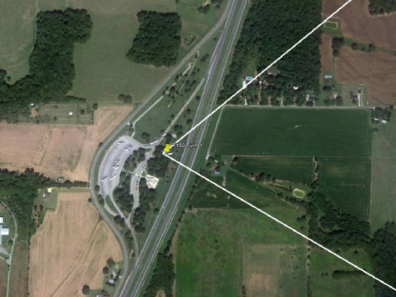
Turn 1 may be familiar to some of you. It is
the Rocket turn from the TVAR races. Turn
altitude is per FARs, announce on top on 122.7. Your
outbound heading is 123 degrees.
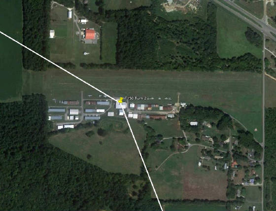
Turn 2 is Moontown airport. Turn altitude is 1,800 feet, turn freq is 122.7. Outbound heading to Turn 3 is 162 degrees.
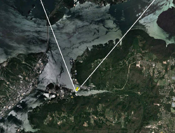
Inbound to Turn 3 you will pass just over 1 NM from
Joe Starnes Field. Be at Turn
3 altitude of 1,800 feet by 4.5 NM of the turn in order to remain clear of airport traffic. Turn freq is 122.8. Your outbound heading to Turn 4 is 044 degrees.
Turn 3 is the East end of the East/West bridge.
There are three bridges in close proximity
but a turn spotter on only one of them. Mark them well for your own success.
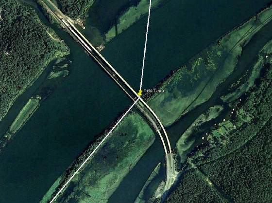
Turn 4 is the South end of the bridge at Scottsboro.
Outbound from this turn you will
pass within 1.7 NM from the Scotsboro airport hence the turn altitude is 1,800 feet.
The distance between Turn 3 and
Turn 4 is 23 NM so depending on winds you can decide whether to remain at 1,800 from 4.5 inbound to turn 3, until 5 NM beyond
Turn 4 - or yoyo in between. Either way remain at 1,800 feet until 5 NM beyond Turn 4. Turn freq is 122.8. Your outbound heading to Turn 5 is 010 degrees.
Turn 5 is
Franklin County airport (elevation
1,953). The turn point is
the numbers at the North end of the runway. Turn freq is 122.8. Turn altitude is 3,000 feet. Outbound heading to Turn 6 is 283 degrees.
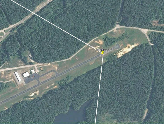
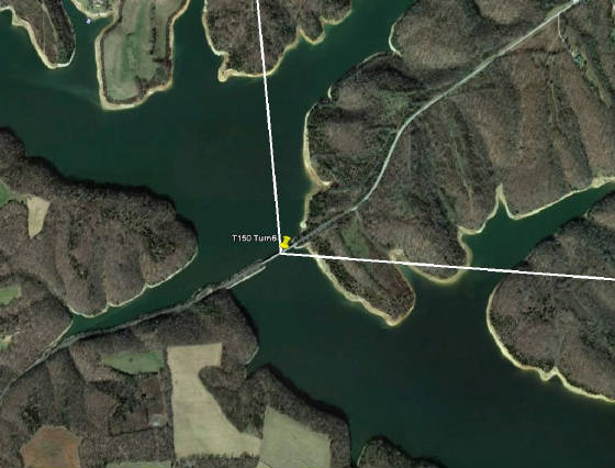
Turn 6 is the East end of the bridge on Tims
Ford Lake. Turn freq is 122.8,
turn altitude is per FARs. Your
outbound heading to the finish line is 003 degrees. Switch to the finish freq 123.0.
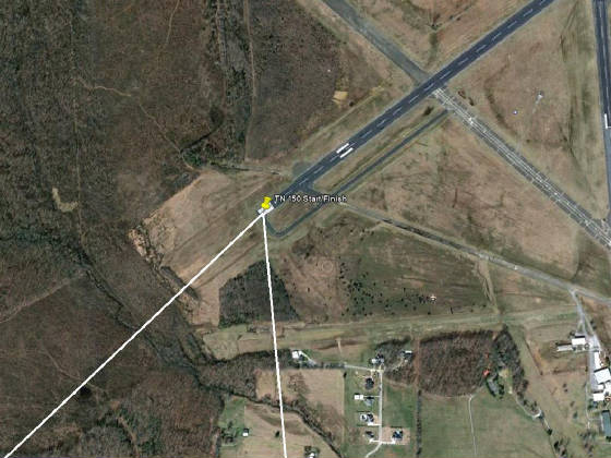
The finish line is the same as the start, the numbers (number) at
the South end of 24/06. Finish altitude is AGL, finish freq is 123.0. For recovery on runway 18, reduce power after crossing the
finish, turn North and climb to 2,000 feet on a right downwind to 18. For recovery on 36, reduce power after crossing the finish line, Turn North and climb to 2,000
feet on upwind to a right crosswind to 36. Recovery
procedures subject to change at the brief.
|