- Home
- About SARL
- Media
- Race Hosts
- Race Results
- Race Memories
Sport Air Racing League
Racing for the Rest of Us!
You are here
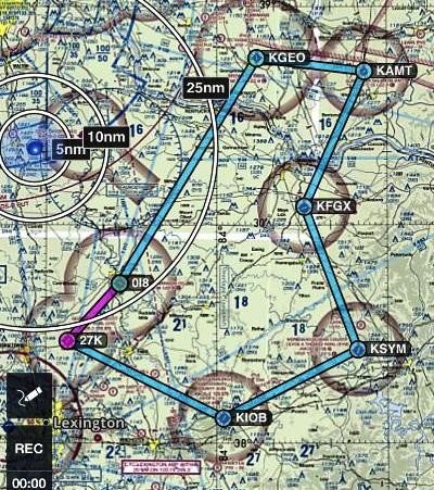
2024 Bluegrass 150 Long Course
2024 Bluegrass 150 Long Course Information
Long Course:
Start: 38.37*N/ 84.29*W Cynthiana, KY (0I8)
Turn 1: 38.23*N/84.43*W Georgetown, KY (27K)
Turn2: 38.06*N/83.98*W Mt Sterling, KY (KIOB)
Turn 3: 38.21*N/83.59*W Morehead, KY (KSYM)
Turn 4: 38.54*N/83.75*W Fleming Mason, KY (KFGX)
Turn 5: 38.85*N/83.56*W Alex Salomon, OH (KAMT)
Turn 6: 38.88*N/83.88*W Brown County, OH (KGEO)
Finish: 38.37*N/84.29*W Cynthiana, KY (0I8)
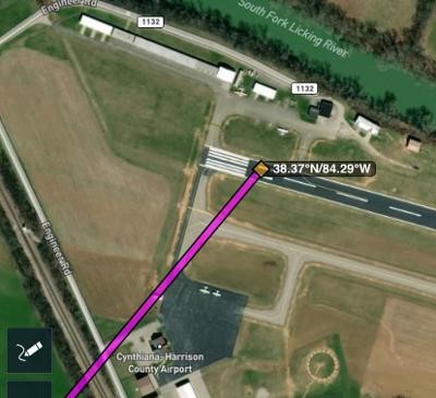
Start as directed. The picture shows takeoff to the northwest. Call your start on 122.8 (EX: " Race 5, rolling") After leaving the pattern, switch to 123.0.
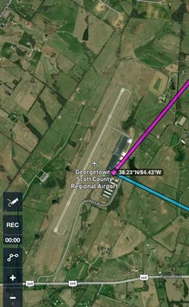
Turn 1: over the FBO at a minimum altitude of 2100 ft (200 ft above pattern) Turn frequency is 123.0, switch to frequency 122.8 after turning.
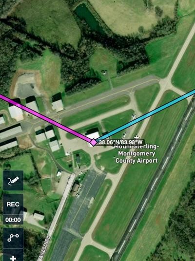
Turn 2: Turn frequency is 122.8. Minimum altitude over the airport is 2200 ft. Switch to frequency 122.7 after turning.
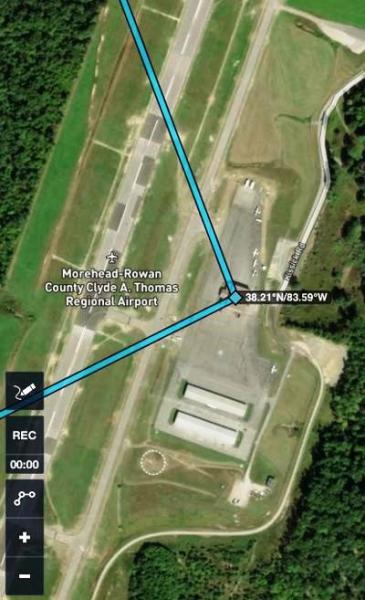
Turn 3. Turn frequency is 122.7. Minimum altitude over the airport is 2200 ft. Switch to 123.0 after leaving the vicinity.
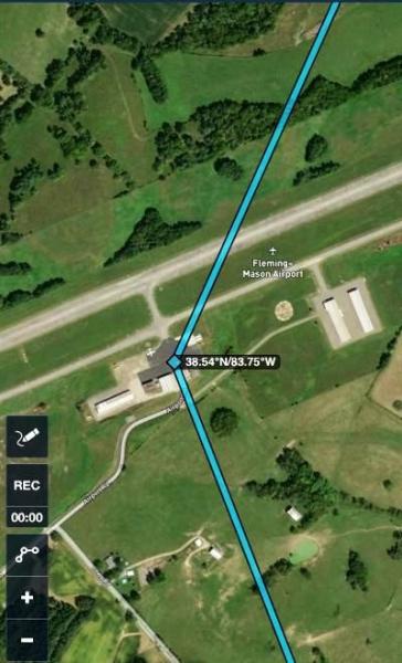
Turn 4. Turn frequency is 123.0. Minimum altitude 2100 feet. Switch to 122.8 after leaving the vicinity.
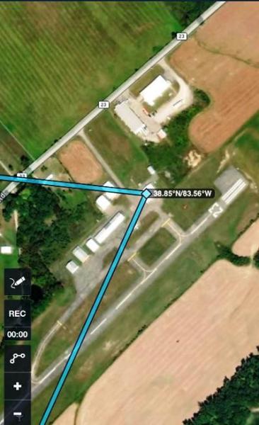
Turn 5. Frequency is 122.8. Minimum altitude is 2100 ft. There are many similar buildings, the FBO is closest to the approach end of runway 23. Switch to 122.9 after leaving the vicinity. NOTE: between Turns 5 and 6, there are towers in the flight path. Watch your altitude!
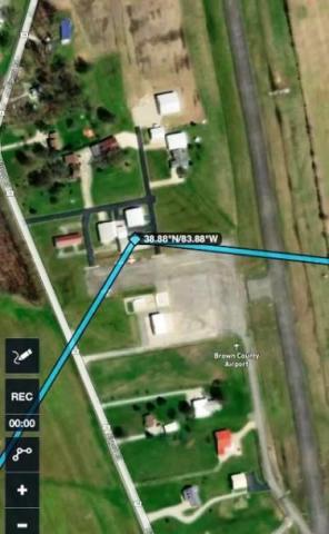
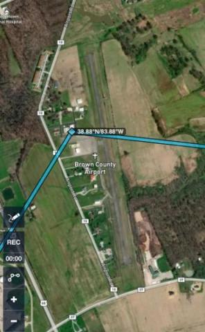
Turn 6: Turn frequency is 122.9 Minimum altitude is 2200 feet. This is a difficult runway to see and there are many buildings lining the runway. Look for the FBO just north of the runway midpoint, near where the road curves. Switch to 122.8 after leaving the vicinity.

Finish: Call on 122.8 at 5 miles out ("Race 5 is 5 miles out) and repeat at 1 mile out.
The finish point will be at the juncture of the taxiways. Finish altitude is a minimum of 1900 ft.
Which runway is used for takeoff and landing will be decided the morning of the race.
Theme by Danetsoft and Danang Probo Sayekti inspired by Maksimer