- Home
- About SARL
- Media
- Race Hosts
- Race Results
- Race Memories
Sport Air Racing League
Racing for the Rest of Us!
You are here
Big Sky Air Race Short Course
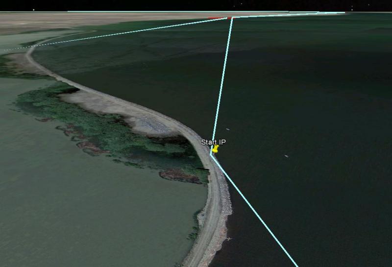
All racers will launch from Townsend and proceed to the IP (Initial Point). 46° 22.236'N 111° 32.092'W.
This should be your first GPS point in the flight plan. See image above.
Remain on 122.8 for the start.
At the Start IP you will turn to the Start point, 46° 25.099'N 111° 34.284'W. Your start time will be hacked as you pass abeam the marina (approximately the red line, depending on the sighting the timers use), but as far as the pilots are concerned the start is this start point. Be at max speed inbound to the start. Turn on the point of land at the Start but make a start call as you are abeam the marina on 122.8.
Note that on the start you are within the traffic pattern of 8U9 - but we expect little to no traffic on race day.
Heads Up!
Start altitude per FARS but less than 1,000 AGL (for identification and to keep you out of the 8U9 traffic pattern.
Once you pass the start line, your outbound heading to Turn 1 is 342 degrees.
Switch to 123.45.

Turn 1 will be a point abeam and 500 feet off shore of the White Earth Recreation Area marina and campgrounds (turn on the green rowboat).
46° 31.337’N 111° 35.046’W
Inbound towards Turn 1 you will aim towards a point of land just south of the actual turn. See above.

To assist in your accurate turn on this admittedly difficult turn point, we've included a shot (above) which shows that you make your turn when you are abeam the campground inlet. When you see what that picture shows, turn towards Turn 2.
Turn altitude per FARs.
Turn freq. 123.45
Your outbound heading to Turn 2 is 311 degrees.
Remain on race frequency 123.45.
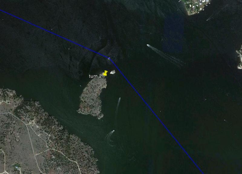
Turn 2 will be Cemetery island.
46° 38.175N 111° 42.303W
Turn altitude per FARs.
Turn freq. 123.45
Your outbound heading to Turn 3 is 284 degrees.
Remain on race frequency 123.45.
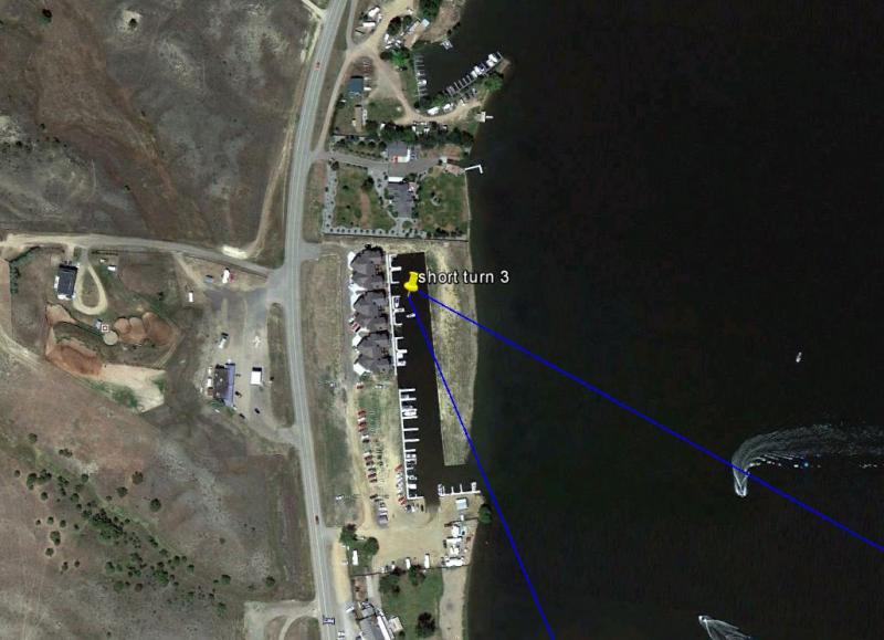
Turn 3 will be the marina.
46° 40.848'N 111° 50.042'W
Turn altitude per FARs.
Turn freq. 123.45
Your outbound heading to Turn 4 is 143 degrees.
Remain on race frequency 123.45.
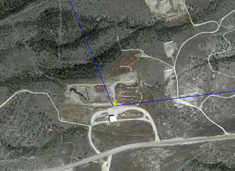
Turn 4 will be a white building.
46° 20.141'N 111° 36.365'W
Turn altitude per FARs.
Turn freq. 123.45
Your outbound heading to Turn 5a is 068 degrees.
Remain on race frequency 123.45.
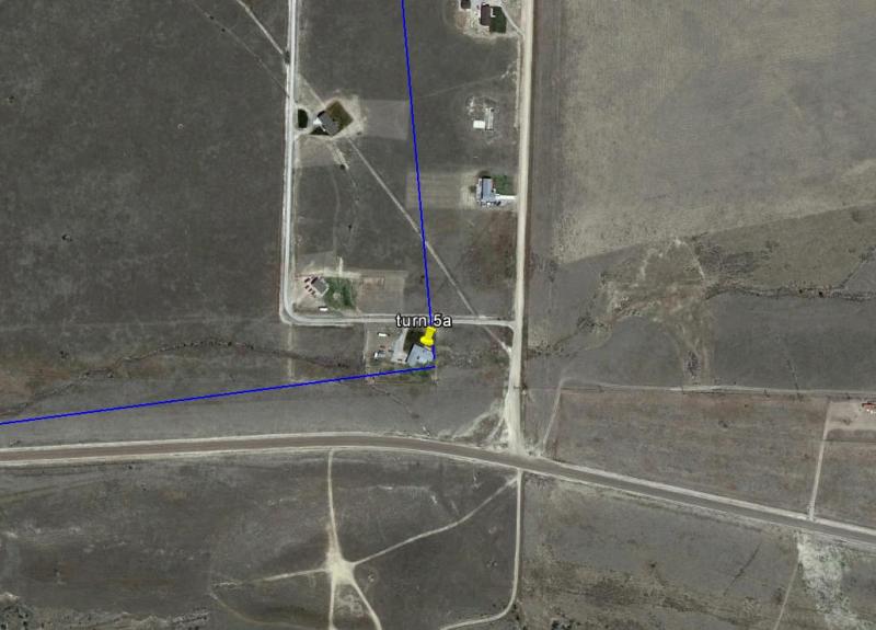
Turn 5a will be another building.
46° 20.481'N 111° 33.478'W
Turn altitude per FARs.
Turn freq. 123.45
Your outbound heading to the Finish is 341 degrees.
Switch to 122.8

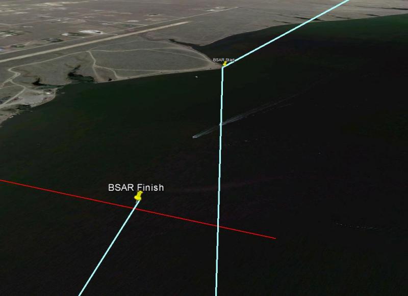
This image shows the merge angle between the short course and the long course.
Watch for merging traffic at the finish!

The Finish will be East of Canyon Ferry Airport (8U9). Specifically, abeam and 500 feet off shore of the Canyon Ferry marina.
46° 24.835'N 111° 34.148'W
As you are inbound to the finish your aim point is a point of land beyond the finish line. Head for that point of land and your time will be taken as you pass abeam the marina (see picture).
Finish altitude: On this run-in line you will be 1,000 lateral feet from the marina however be cautious of boats in the area as well as traffic for 8U9 (small chance).
Call your finish on 122.8
After crossing the finish line (continue on heading for several seconds to make sure you get a finish time), make a climbing right turn, remain on 122.8 and head for Townsend (131 degrees) for a normal recovery.
Remember that you are on the Finish frequency and make brief and minimum pattern calls to avoid stepping on a fellow racer.
Theme by Danetsoft and Danang Probo Sayekti inspired by Maksimer